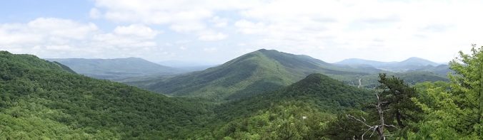
The past week has been spent hiking on the ridges of Virginia. Rather than a series of domes, the Virginia mountains have more of a ridge-like character. The trail generally follows the spine of the ridge. On each side is a grassy green valley with another ridge behind it.
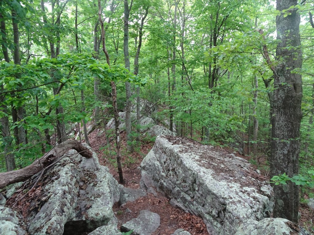
I have a love-hate relationship with these sections of trail. Sometimes after hours of picking my way around and over boulders, I am thinking, “When will these rocks ever end?”
In other places, the ridge top might be a grassy forest road with views into the valley through the trees. Stolling through these sections while taking in the scenery, I think, “Wow! This is what the AT is all about.”
Clear Sailing
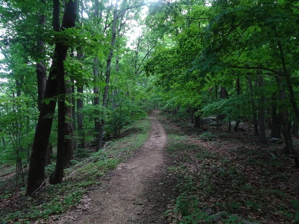
Often when hiking in the “green tunnel”, I have little perspective on where I am going. Only when I look back do I see where the trail has taken me.
Looking back at where I’ve been
The rock formation, known as “Dragon’s Tooth”, is a popular day hiker destination. It looked not too difficult to climb it from the back side to perch oneself on the top of the tooth. I was considering this when I remembered Nancy’s words, “In all situations, ask yourself, what would Nancy do?” I mentioned this to another hiker. She said my motto should be WWND.
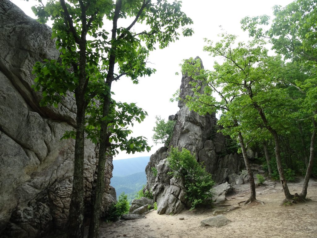
Dragon’s Tooth
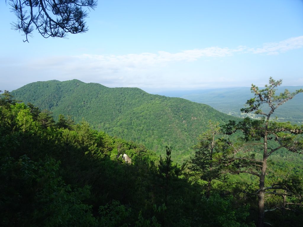
The trail also took me to the summit of McAfee Knob and skirted Tinker Cliffs. These two points of interest, along with the Dragon’s Tooth are called the Triple Crown by Virginia hikers.
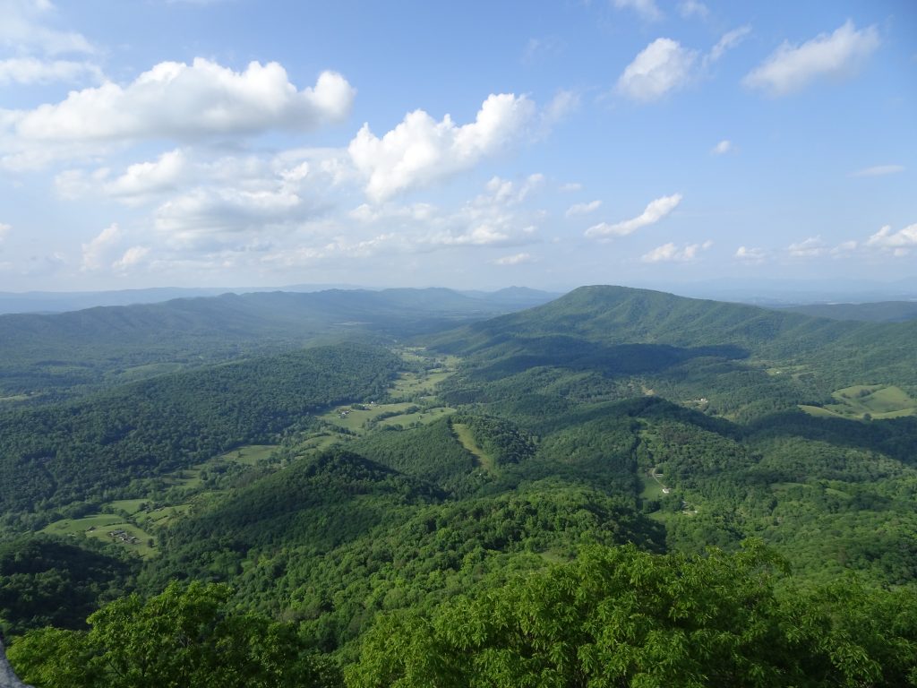
View from McAfee Knob
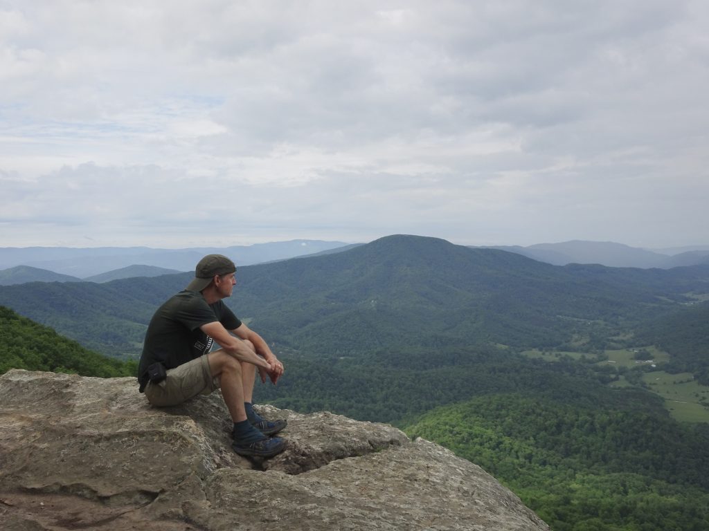
Looking back at McAfee Knob from Tinker Cliffs
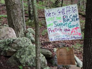
A big source of controversy in this area of Virginia is the Mountain Valley Pipeline. For a couple of years, I had been hearing about this natural gas pipeline which will actually cross under the trail at one point. I did not expect it to be “a thing” out on the trail. Before leaving Pearisburg, I read in the Roanoke Times about two women (one named Fern, the other named Nutty) who were camped on rope-suspended wood platforms blocking the drillers. The authorities have apparently been trying unsuccessfully to starve them out by arresting anyone who tries to bring them supplies.
No sooner had I hit the trail out of Pearisburg than I ran into a Forest Service ranger. He politely told me, in effect, to stay on the trail and mind my own business. The reason for this became clear when I came open a colorful sign, and a few miles later, police tape.
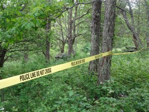
This is part of a bigger battle between the petroleum interests and the environmental folks would want to stop fracking and reduce fossil fuel consumption. The AT is just the poster child. After all, who doesn’t like a trail? As a thru hiker, my selfish view is that the pipeline would not much diminish my experience as I am already passing under power lines nearly every day. As a local person who will now have to look up at a new stripe down the mountain, I am sure I would feel quite differently.
I have seen a few turtles along the trail. Here is a very colorful box turtle I saw in a cow pasture.

Woodland Box Turtle
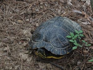
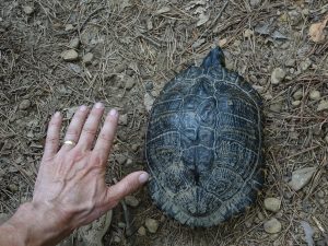
Just the other day, I saw this very large turtle right on the path of the trail. He’s too large to be a box turtle. After some Googling, I suspect this is a turtle called a Cooter. Cooters are aquatic turtles, but there was a stream within a few hundred yards.
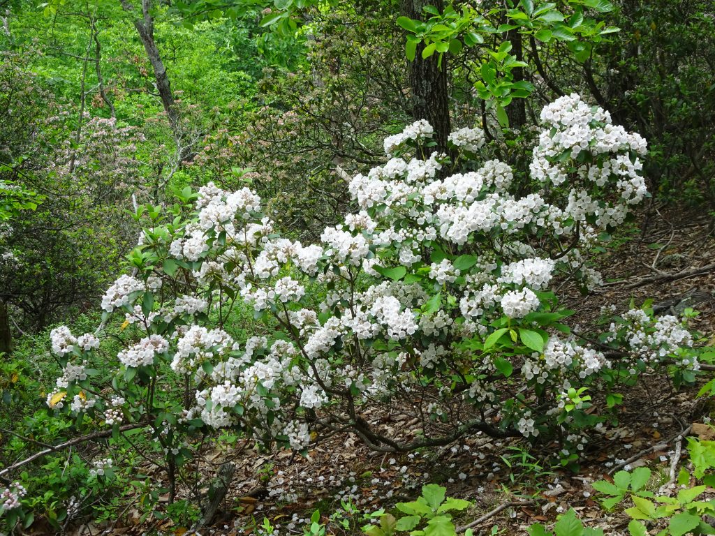
This past week, the mountain laurel has come into full bloom. The laurel grow in large splashy groves, but are most beautiful when viewed closely. Most are predominantly white, but some shade towards pink.
Mountain Laurel

Up Close

Pink Variety
On the birding and lepidopterology front…

Wood Thrush
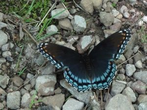
Red-spotted Purple
If you’d like to receive an email when a new post is up on the blog, click the email icon on the bottom of the page to subscribe. Thanks for following!
Nancy gave me a little background on your trip Randy. Really enjoying your blog. Be safe. WWND is great!
I would think now that heat is upon us, you must be thirsty all the time. How do you keep enough water without it weighing you down? Really enjoying following your travels!
I have a trail guide that lists the mile markers for the water sources, typically 3-6 miles apart. This takes the guesswork out carrying water. I try to carry only what’s needed to get to the next source, usually one liter or less.
Enjoying the posts! Thanks for sharing this adventure with us!
Watch for Harvey Lewis coming through on his AT speed record attempt!
http://www.roadid.com/wheresharvey
Looks like I am about 450 miles ahead of Harvey. I will keep an eye on his web site and look for him blazing past.
Randy,
It’s great to see you are having such a wonderful experience. One of my favorite memories growing up was our annual Boy Scout trip to Dragon’s Tooth for a weekend of Hiking and Rappelling. Thanks for sharing.
Kailen